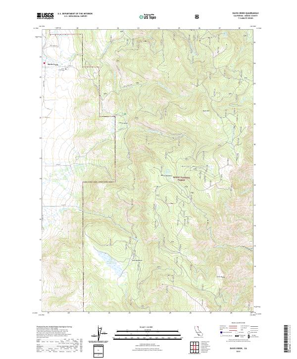
2021 Map of Davis Creek
USGS Topo · Published 2021About this map
The Warner Mountains dominate the eastern reaches of this Modoc County landscape, where high-altitude springs like Needle Grass Spring and Benton Meadow Spring feed a network of creeks. In the west, the small settlement of Davis Creek serves as a local hub near the Davis Creek Cem and the waters of Bishop Lake. This area reflects the typical land use patterns of northeastern California, with the Modoc National Forest covering the rugged interior slopes and higher elevations. Ranching and water management are evident through features like Halls Meadows Reservoir and named meadows including Benton Meadow and Halls Meadows. Smaller locales such as Little Valley and Plum Valley are connected by a network of rural roads, including Plum Valley Rd, which navigate the complex terrain between Little Baldy and Buck Mtn.
Find a feature on this map
42 named features on this map. Tap any name to fly to it.
Don’t see what you’re looking for? This feature index may not catch every label — zoom into the map to look around manually.
Map Details
Editions of this 2021 Davis Creek Map
This is the sole edition of this map. No revisions or reprints were ever made.
Other maps of this area

1886 · Alturas
USGS Topo · 1:250,000

1892 · Alturas
USGS Topo · 1:250,000

1954 · Alturas
USGS Topo · 1:250,000

1958 · Alturas
USGS Topo · 1:250,000

1962 · Alturas
USGS Topo · 1:250,000

1962 · Davis Creek
USGS Topo · 1:62,500

1962 · Willow Ranch
USGS Topo · 1:62,500

1962 · Cedarville
USGS Topo · 1:62,500

1962 · Fort Bidwell
USGS Topo · 1:62,500

1965 · Alturas
USGS Topo · 1:250,000