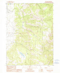
1990 Map of Davis Creek
USGS Topo · Published 1990About this map
The Warner Mountains dominate this landscape on the eastern side of Modoc National Forest, where steep ridgelines give way to the drainage basins of the North Fork, Middle Fork, and South Fork Davis Creek. Settlement is concentrated along the western flats near the community of Davis Creek, where the terrain transitions from high mountain slopes to the more level areas around Linnville. This 1990 edition, based on field checks from the late 1980s, captures a transition in land use, showing both recreational sites like the Plum Valley Campground and industrial marks such as a Gravel Pit near Benton Meadow.
Find a feature on this map
28 named features on this map. Tap any name to fly to it.
Don’t see what you’re looking for? This feature index may not catch every label — zoom into the map to look around manually.
Map Details
Editions of this 1990 Davis Creek Map
This is the sole edition of this map. No revisions or reprints were ever made.
Other maps of this area

1886 · Alturas
USGS Topo · 1:250,000

1892 · Alturas
USGS Topo · 1:250,000

1954 · Alturas
USGS Topo · 1:250,000

1958 · Alturas
USGS Topo · 1:250,000

1962 · Alturas
USGS Topo · 1:250,000

1962 · Davis Creek
USGS Topo · 1:62,500

1962 · Willow Ranch
USGS Topo · 1:62,500

1962 · Cedarville
USGS Topo · 1:62,500

1962 · Fort Bidwell
USGS Topo · 1:62,500

1965 · Alturas
USGS Topo · 1:250,000