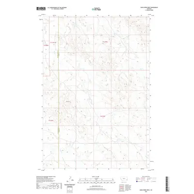
2020 Map of Davis Creek West
USGS Topo · Published 2020About this map
Pine Hill stands as a prominent landmark in this southeastern Montana landscape, situated near the north-south boundary dividing Powder River and Carter counties. The terrain is defined by a dense network of intermittent drainage systems, characteristic of the region's high plains topography. A complex watershed is visible here, where headwaters and tributaries like Stump Creek, Dry Creek, and Davis Creek carve through the dissected uplands. The mapping of these ephemeral streams, including South Dry Creek and Honeycomb Creek, illustrates the intricate erosion patterns that shape this cattle-country environment. This 2020 survey captures the area's remote character, where the Public Land Survey System grid provides the primary human structure over a land largely defined by its hydrology and natural relief.
Find a feature on this map
14 named features on this map. Tap any name to fly to it.
Don’t see what you’re looking for? This feature index may not catch every label — zoom into the map to look around manually.
Map Details
Editions of this 2020 Davis Creek West Map
This is the sole edition of this map. No revisions or reprints were ever made.
Other maps of this area

1954 · Ekalaka
USGS Topo · 1:250,000

1956 · Ekalaka
USGS Topo · 1:250,000

1958 · Ekalaka
USGS Topo · 1:250,000

1965 · Ekalaka
USGS Topo · 1:250,000

1979 · W L Butte
USGS Topo · 1:24,000

1979 · Blacktail Creek SE
USGS Topo · 1:24,000

1979 · Blacktail Creek SW
USGS Topo · 1:24,000

1979 · Powderville
USGS Topo · 1:24,000

1979 · Rattlesnake Ridge
USGS Topo · 1:24,000

1979 · McKenzie Creek
USGS Topo · 1:24,000