
1979 Map of Rattlesnake Ridge
USGS Topo · Published 1979About this map
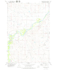
The Powder River cuts through the northwest corner of this southeastern Montana landscape, where the high prairie begins its ascent into the prominent landforms of Rattlesnake Ridge and Cedar Ridge. This 1970s survey captures a sparsely populated ranching and grazing environment, anchored by the Powderville Sch and the winding Powderville Road. The presence of a remote Landing Strip and numerous wells across the terrain underscores the logistical requirements of managing large tracts of land far from major population centers.
Find a feature on this map
26 named features on this map. Tap any name to fly to it.
Don’t see what you’re looking for? This feature index may not catch every label — zoom into the map to look around manually.
Map Details
Editions of this 1979 Rattlesnake Ridge Map
This is the sole edition of this map. No revisions or reprints were ever made.
Other maps of this area

1954 · Ekalaka
USGS Topo · 1:250,000

1956 · Ekalaka
USGS Topo · 1:250,000

1958 · Ekalaka
USGS Topo · 1:250,000

1965 · Ekalaka
USGS Topo · 1:250,000

1979 · Deer Creek Buttes
USGS Topo · 1:24,000

1979 · Blacktail Creek SW
USGS Topo · 1:24,000

1979 · Powderville
USGS Topo · 1:24,000
1979 · Oliphant Butte
USGS Topo · 1:24,000

1979 · McKenzie Creek
USGS Topo · 1:24,000
1979 · Pocochichee Butte
USGS Topo · 1:24,000