
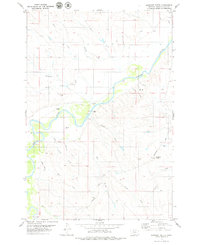
1979 Map of Deer Creek Buttes
USGS Topo · Published 1979About this map
The Powder River carves through the northwestern corner of this 1970s landscape in Montana, a region defined by extensive drainage networks and high-country landmarks. The eponymous Deer Creek Buttes dominate the central terrain, serving as a primary navigational point for the surrounding cattle country. Transport in this period was facilitated by the Powerville Road and a notable Landing Strip located near Deer Creek, illustrating how aviation and gravel roads connected these remote rangelands. Numerous watercourses, such as the North Fork Horse Creek and South Fork Horse Creek, illustrate the complex hydrology of the Powder River Basin. Resource exploration is evident through several marked drill holes, while the inclusion of the Poker Jim Creek and Little Pilgrim Creek drainages provides fine-grained detail for land researchers and genealogists tracing historical property lines and water rights in this corner of Big Sky Country.
Find a feature on this map
16 named features on this map. Tap any name to fly to it.
Don’t see what you’re looking for? This feature index may not catch every label — zoom into the map to look around manually.
Map Details
Editions of this 1979 Deer Creek Buttes Map
This is the sole edition of this map. No revisions or reprints were ever made.
Other maps of this area

1954 · Ekalaka
USGS Topo · 1:250,000

1956 · Ekalaka
USGS Topo · 1:250,000

1958 · Ekalaka
USGS Topo · 1:250,000

1965 · Ekalaka
USGS Topo · 1:250,000

1973 · Cross S School
USGS Topo · 1:24,000

1973 · Monday Creek
USGS Topo · 1:24,000

1973 · Hawkey Creek
USGS Topo · 1:24,000

1979 · Rattlesnake Ridge
USGS Topo · 1:24,000
1979 · Oliphant Butte
USGS Topo · 1:24,000

1979 · McKenzie Creek
USGS Topo · 1:24,000