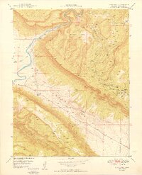
1949 Map of Davis Mesa
USGS Topo · Published 1949About this map
The Dolores River carves through this corner of Montrose County, where the United States Atomic Energy Commission and the USGS collaborated to document a landscape defined by uranium and vanadium extraction. The eastern portion of the map is dominated by a dense cluster of claims including the Tramp No 2 Mine, Vanadate Mine, and Coloradium Mine. These workings follow the geological contours above the Paradox Valley, connected by the winding Long Park Road.
Find a feature on this map
25 named features on this map. Tap any name to fly to it.
Don’t see what you’re looking for? This feature index may not catch every label — zoom into the map to look around manually.
Map Details
Editions of this 1949 Davis Mesa Map
2 editions found
Other maps of this area

1916 · Paradox Valley
USGS Topo · 1:125,000

1922 · Paradox Valley
USGS Topo · 1:125,000

1948 · Roc Creek
USGS Topo · 1:24,000

1948 · Bull Canyon
USGS Topo · 1:24,000

1948 · Uravan
USGS Topo · 1:24,000

1948 · Naturita NW
USGS Topo · 1:24,000

1948 · Paradox
USGS Topo · 1:24,000

1949 · Bull Canyon
USGS Topo · 1:24,000

1949 · Davis Mesa
USGS Topo · 1:24,000

1949 · Uravan
USGS Topo · 1:24,000