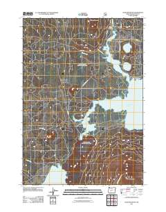
2011 Map of Davis Mountain
USGS Topo · Published 2011About this map
The Wickiup Reservoir dominates the eastern portion of this Deschutes County landscape, where the waters of the Deschutes River and Browns Creek converge. This 2011 survey details a region defined by its volcanic topography and significant water bodies, including the perfectly paired North Twin Lake and South Twin Lake. The road network, including the Cascade Lakes HWY and Wickiup Reservoir RD, facilitates access to the shorelines and recreational points like the North Wickiup Campground.
Find a feature on this map
23 named features on this map. Tap any name to fly to it.
Don’t see what you’re looking for? This feature index may not catch every label — zoom into the map to look around manually.
Map Details
Editions of this 2011 Davis Mountain Map
This is the sole edition of this map. No revisions or reprints were ever made.
Other maps of this area

1930 · Maiden Peak
USGS Topo · 1:125,000

1934 · Maiden Peak
USGS Topo · 1:125,000

1955 · Crescent
USGS Topo · 1:250,000

1957 · Crescent
USGS Topo · 1:250,000

1958 · Crescent
USGS Topo · 1:250,000

1963 · Round Mountain
USGS Topo · 1:24,000

1963 · Hamner Butte
USGS Topo · 1:24,000
1963 · The Twins
USGS Topo · 1:24,000
1963 · Odell Lake
USGS Topo · 1:24,000
1963 · Irish Mountain
USGS Topo · 1:24,000