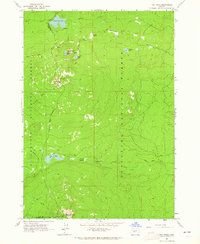
1963 Map of The Twins
USGS Topo · Published 1965About this map
The Twins and Maiden Peak dominate this high-elevation landscape along the boundary of Lane and Deschutes counties. Mapped in the early 1960s, this area is defined by its network of alpine lakes and extensive trail systems that weave between the Willamette and Deschutes national forests. Significant water bodies like Charlton Lake, Bobby Lake, and the smaller Hidden Lake are scattered across the terrain, connected by the historic Skyline Trail and the Twin Peaks Trail.
Find a feature on this map
27 named features on this map. Tap any name to fly to it.
Don’t see what you’re looking for? This feature index may not catch every label — zoom into the map to look around manually.
Map Details
Editions of this 1963 The Twins Map
4 editions found
Other maps of this area

1925 · Waldo Lake
USGS Topo · 1:125,000

1930 · Maiden Peak
USGS Topo · 1:125,000

1934 · Maiden Peak
USGS Topo · 1:125,000

1955 · Chucksney Mtn
USGS Topo · 1:62,500

1955 · Crescent
USGS Topo · 1:250,000

1956 · Waldo Lake
USGS Topo · 1:62,500

1957 · Crescent
USGS Topo · 1:250,000

1958 · Crescent
USGS Topo · 1:250,000

1958 · Roseburg
USGS Topo · 1:250,000

1959 · Roseburg
USGS Topo · 1:250,000