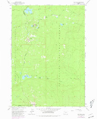
1963 Map of The Twins
USGS Topo · Published 1981About this map
Deschutes National Forest and Willamette National Forest converge at the high-altitude volcanic landscape of the central Cascade Range. The map area is defined by a dense network of glacial lakes and volcanic summits, notably The Twins and Maiden Peak. For recreation and transport, a significant primitive trail system is documented, including the long-distance Skyline Trail and the Crane Prairie Trail, which navigate between prominent water bodies like Charlton Lake and Bobby Lake. The terrain is characterized by high-elevation meadows, such as Round Meadow and Poverty Meadows, and numerous volcanic features like Gerdine Butte and Charlton Butte. This 1963 survey, updated with 1970s aerial data, provides a detailed record of the wilderness boundary between Lane and Deschutes counties before modern development altered these backcountry routes.
Find a feature on this map
25 named features on this map. Tap any name to fly to it.
Don’t see what you’re looking for? This feature index may not catch every label — zoom into the map to look around manually.
Map Details
Editions of this 1963 The Twins Map
4 editions found
Other maps of this area

1925 · Waldo Lake
USGS Topo · 1:125,000

1930 · Maiden Peak
USGS Topo · 1:125,000

1934 · Maiden Peak
USGS Topo · 1:125,000

1955 · Chucksney Mtn
USGS Topo · 1:62,500

1955 · Crescent
USGS Topo · 1:250,000

1956 · Waldo Lake
USGS Topo · 1:62,500

1957 · Crescent
USGS Topo · 1:250,000

1958 · Crescent
USGS Topo · 1:250,000

1958 · Roseburg
USGS Topo · 1:250,000

1959 · Roseburg
USGS Topo · 1:250,000