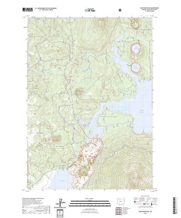
2024 Map of Davis Mountain
USGS Topo · Published 2024About this map
Deschutes National Forest encompasses this high-elevation landscape, where volcanic peaks and recreational waters define the geography. The prominent volcanic profile of Davis Mtn and the cinder cone of Pine Butte overlook a complex network of waterways, including the significant expanse of the Wickiup Reservoir and the naturally occurring Davis Lake. The map reveals a dense system of historic and modern routes such as the Metolius-Windigo Trl and Charlton Trl, which connect various landmarks across the Cascade Range. This 2024 edition documents the current state of these high-desert riparian zones, showing how drainage from Browns Creek and North Davis Creek feeds into the larger reservoir system. For those interested in the topography of the central Cascades, the map details the distinct basins of North Twin Lake and South Twin Lake, which remain popular focal points for local recreation and environmental study.
Find a feature on this map
26 named features on this map. Tap any name to fly to it.
Don’t see what you’re looking for? This feature index may not catch every label — zoom into the map to look around manually.
Map Details
Editions of this 2024 Davis Mountain Map
This is the sole edition of this map. No revisions or reprints were ever made.
Other maps of this area

1930 · Maiden Peak
USGS Topo · 1:125,000

1934 · Maiden Peak
USGS Topo · 1:125,000

1955 · Crescent
USGS Topo · 1:250,000

1957 · Crescent
USGS Topo · 1:250,000

1958 · Crescent
USGS Topo · 1:250,000

1963 · Round Mountain
USGS Topo · 1:24,000

1963 · Hamner Butte
USGS Topo · 1:24,000
1963 · The Twins
USGS Topo · 1:24,000
1963 · Odell Lake
USGS Topo · 1:24,000
1963 · Irish Mountain
USGS Topo · 1:24,000