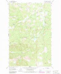
1963 Map of Davis Mountain
USGS Topo · Published 1984About this map
The Kootenai National Forest dominates this mountain landscape, defined by steep drainage basins and early forest management infrastructure. Established as a vital vantage point for fire detection, the Davis Mountain Lookout Tower stands near the southern boundary, overlooking the convergence of several major creek systems. The terrain is marked by the rugged Cliff faces below Sheep Mountain, while a network of high-elevation trails, labeled simply as Pack Trail, provide the primary access through these wooded sections of Lincoln County. Drainage is provided by a complex web of waterways including Fivemile Creek and Swamp Creek, whose forks carve deep into the timbered slopes. The presence of numerous unnamed Springs and the detailed mapping of the North Fork and South Fork of local streams suggests a landscape largely managed for its hydrological and timber resources during the mid-20th century.
Find a feature on this map
19 named features on this map. Tap any name to fly to it.
Don’t see what you’re looking for? This feature index may not catch every label — zoom into the map to look around manually.
Map Details
Editions of this 1963 Davis Mountain Map
2 editions found
Other maps of this area

1913 · Stryker
USGS Topo · 1:125,000

1916 · Stryker
USGS Topo · 1:125,000

1920 · Jennings
USGS Topo · 1:125,000

1935 · Thompson Lakes
USGS Topo · 1:96,000

1942 · Thompson Lakes
USGS Topo · 1:125,000

1957 · Kalispell
USGS Topo · 1:250,000

1960 · Kalispell
USGS Topo · 1:250,000

1961 · Kalispell
USGS Topo · 1:250,000

1963 · Mc Guire Mountain
USGS Topo · 1:24,000

1963 · Davis Mountain
USGS Topo · 1:24,000