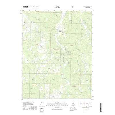
2017 Map of Davisville
USGS Topo · Published 2017About this map
Huzzah Creek meanders through the central corridor of this Crawford County landscape, defining a valley where the settlement of Davisville serves as a focal point. The surrounding terrain is heavily dissected by numerous hollows, including Davisville Hollow and Pyatt Hollow, which separate high points like Green Hill and Bald Knob. This area within the Mark Twain National Forest is notably rich in family-named cemeteries, which are scattered throughout the hills near old homesteads and roads. Researchers can identify Dohammer Cem, Skaggs Cem, and Turnbough Cem, among others. Along the eastern banks of the creek, prominent limestone features such as Indian Rock Bluff and Red Bluff rise above the water, while the presence of Woodlock Spring suggests the importance of natural water sources in this rural Ozark setting.
Find a feature on this map
69 named features on this map. Tap any name to fly to it.
Don’t see what you’re looking for? This feature index may not catch every label — zoom into the map to look around manually.
Map Details
Editions of this 2017 Davisville Map
This is the sole edition of this map. No revisions or reprints were ever made.
Other maps of this area

1932 · Steelville
USGS Topo · 1:48,000

1933 · Steelville
USGS Topo · 1:62,500

1937 · Steelville
USGS Topo · 1:62,500

1941 · Stone Hill
USGS Topo · 1:62,500

1943 · Berryman
USGS Topo · 1:62,500

1943 · Boss
USGS Topo · 1:62,500

1945 · Stone Hill
USGS Topo · 1:62,500

1945 · Berryman
USGS Topo · 1:62,500

1946 · Boss
USGS Topo · 1:62,500

1949 · Rolla
USGS Topo · 1:250,000