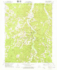
1978 Map of Davisville
USGS Topo · Published 1979About this map
Davisville serves as a focal point within the Mark Twain National Forest, where the winding course of Huzzah Creek dictates the local geography. The landscape is defined by its numerous family-named cemeteries and rural landmarks, such as Fox Theater Ch and Lookout Ch, which speak to the area's genealogical depth. To the north, the small settlement of Pyatt is situated near the St Louis - San Francisco rail line, illustrating the historical importance of rail transport in these Ozark hollows.
Find a feature on this map
55 named features on this map. Tap any name to fly to it.
Don’t see what you’re looking for? This feature index may not catch every label — zoom into the map to look around manually.
Map Details
Editions of this 1978 Davisville Map
This is the sole edition of this map. No revisions or reprints were ever made.
Other maps of this area

1932 · Steelville
USGS Topo · 1:48,000

1933 · Steelville
USGS Topo · 1:62,500

1937 · Steelville
USGS Topo · 1:62,500

1941 · Stone Hill
USGS Topo · 1:62,500

1943 · Berryman
USGS Topo · 1:62,500

1943 · Boss
USGS Topo · 1:62,500

1945 · Stone Hill
USGS Topo · 1:62,500

1945 · Berryman
USGS Topo · 1:62,500

1946 · Boss
USGS Topo · 1:62,500

1949 · Rolla
USGS Topo · 1:250,000