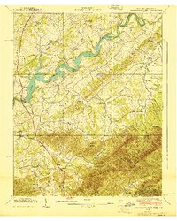
1940 Map of Davy Crockett Lake
USGS Topo · Published 1940About this map
Lake Davy Crockett sits at the heart of this East Tennessee landscape, formed by the Greeneville Dam along the Nolichucky River. The terrain transitions from the lowlands of the river valley to the rising peaks of Chuckey Mountain and the Bald Mountains, where the Pisgah Nat For begins. This 1940 record shows a rural society defined by small settlements and family-named landmarks, such as Staunton Mill and Hayesville.
Find a feature on this map
71 named features on this map. Tap any name to fly to it.
Don’t see what you’re looking for? This feature index may not catch every label — zoom into the map to look around manually.
Map Details
Editions of this 1940 Davy Crockett Lake Map
This is the sole edition of this map. No revisions or reprints were ever made.
Other maps of this area

1892 · Greeneville
USGS Topo · 1:125,000

1894 · Asheville
USGS Topo · 1:125,000

1896 · Greeneville
USGS Topo · 1:125,000

1901 · Asheville
USGS Topo · 1:125,000

1904 · Greeneville
USGS Topo · 1:125,000

1935 · Paint Rock
USGS Topo · 1:24,000

1935 · Mosheim
USGS Topo · 1:24,000

1935 · Cedar Creek
USGS Topo · 1:24,000

1935 · Hot Springs
USGS Topo · 1:24,000

1936 · Greystone
USGS Topo · 1:24,000