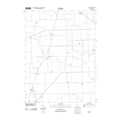
2010 Map of Dawn
USGS Topo · Published 2010About this map
The Stillwater River meanders through this portion of Darke County, shaping a rural landscape defined by small crossroad settlements and a significant concentration of burial grounds. Communities such as Frenchtown, Beamsville, and Stelvideo serve as anchors for the surrounding agricultural tracts. The map reveals a high density of family and community cemeteries, including the Kershner Cemetery, Coppess Cemetery, and Stoner Cemetery, which provide vital touchstones for local genealogical research. Aviation is represented by both the Darke County Airport and Skylane Field, contrasting with the traditional land use patterns of the region. Waterways like Indian Creek, Boyd Creek, and Harris Creek cut through the grid of country roads, while the presence of the Wakefield Lutheran Cemetery and Saint Johns Lutheran Cemetery reflects the religious heritage of the early families who settled this territory north of Greenville.
Find a feature on this map
51 named features on this map. Tap any name to fly to it.
Don’t see what you’re looking for? This feature index may not catch every label — zoom into the map to look around manually.
Map Details
Editions of this 2010 Dawn Map
This is the sole edition of this map. No revisions or reprints were ever made.
Other maps of this area

1908 · St. Henry
USGS Topo · 1:62,500

1909 · Loramie
USGS Topo · 1:62,500

1911 · Loramie
USGS Topo · 1:62,500

1911 · Covington
USGS Topo · 1:62,500

1944 · Covington
USGS Topo · 1:62,500

1944 · Loramie
USGS Topo · 1:62,500

1953 · Muncie
USGS Topo · 1:250,000

1956 · Muncie
USGS Topo · 1:250,000

1961 · Dawn
USGS Topo · 1:24,000
1961 · Greenville East
USGS Topo · 1:24,000