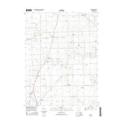
2016 Map of Dawn
USGS Topo · Published 2016About this map
Frenchtown and the village of Dawn anchor this portion of Darke County, where the agricultural grid is deeply intertwined with the winding course of the Stillwater River. The landscape is a study in early Ohio settlement patterns, defined by a dense network of township and county roads that navigate around family-named landmarks and historical community centers. Small clusters of dwellings at Beamsville, Stelvideo, and Pikeville illustrate the enduring nature of these rural crossroads.
Find a feature on this map
126 named features on this map. Tap any name to fly to it.
Don’t see what you’re looking for? This feature index may not catch every label — zoom into the map to look around manually.
Map Details
Editions of this 2016 Dawn Map
This is the sole edition of this map. No revisions or reprints were ever made.
Other maps of this area

1908 · St. Henry
USGS Topo · 1:62,500

1909 · Loramie
USGS Topo · 1:62,500

1911 · Loramie
USGS Topo · 1:62,500

1911 · Covington
USGS Topo · 1:62,500

1944 · Covington
USGS Topo · 1:62,500

1944 · Loramie
USGS Topo · 1:62,500

1953 · Muncie
USGS Topo · 1:250,000

1956 · Muncie
USGS Topo · 1:250,000

1961 · Dawn
USGS Topo · 1:24,000
1961 · Greenville East
USGS Topo · 1:24,000