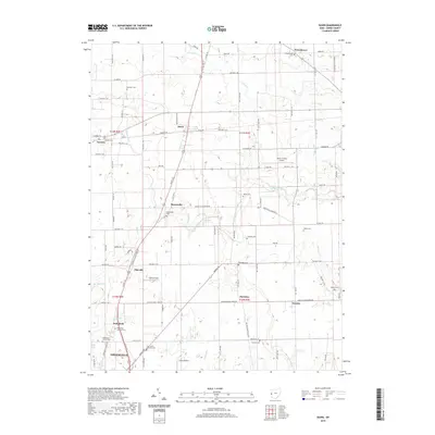
2019 Map of Dawn
USGS Topo · Published 2019About this map
Greenville serves as the southern anchor for this rural landscape in Darke County, where a dense network of township roads and county highways connects small agrarian settlements. The Stillwater River winds through the central portion of the map, flanked by several smaller waterways like Indian Creek and Bolton Run. Genealogists will find a high concentration of burial sites throughout the townships, ranging from the Saint Johns Lutheran Cem and Wakefield Lutheran Cem in the south to the Kershner Cem in the north. The area's transport infrastructure is evidenced by the Darke County Airport and Trump Airport, while the legacy of early villages is preserved in the placement of Beamsville, Stelvideo, and Frenchtown. This survey captures a moment in the modern era where the traditional grid of the Public Land Survey System remains the primary framework for the region's farms and homesteads.
Find a feature on this map
98 named features on this map. Tap any name to fly to it.
Don’t see what you’re looking for? This feature index may not catch every label — zoom into the map to look around manually.
Map Details
Editions of this 2019 Dawn Map
This is the sole edition of this map. No revisions or reprints were ever made.
Other maps of this area

1908 · St. Henry
USGS Topo · 1:62,500

1909 · Loramie
USGS Topo · 1:62,500

1911 · Loramie
USGS Topo · 1:62,500

1911 · Covington
USGS Topo · 1:62,500

1944 · Covington
USGS Topo · 1:62,500

1944 · Loramie
USGS Topo · 1:62,500

1953 · Muncie
USGS Topo · 1:250,000

1956 · Muncie
USGS Topo · 1:250,000

1961 · Dawn
USGS Topo · 1:24,000
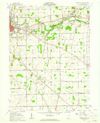
1961 · Greenville East
USGS Topo · 1:24,000