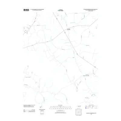
2013 Map of Dawson Crossroads
USGS Topo · Published 2013About this map
Conoconnara Swamp defines the low-lying drainage patterns of this Halifax County landscape, where agriculture and rural intersections anchor the local geography. The map captures a moment in the early 21st century where legacy farm roads and newer developments coexist. Settlements like Crowells Crossroads and Dawson Crossroads serve as central points for a network of named thoroughfares, reflecting a long history of family-owned land and timber operations. Notable landmarks include the Dunroamin Farms Airport and large agricultural tracts such as Douglas Hill Farm Rd and W W Cotton Farm Rd. Smaller waterways, including Hales Millpond Br and Deep Cr, cut through the terrain, illustrating the importance of natural drainage in this coastal plain environment. The road network, including Thirteen Bridges Rd, highlights the connectivity required for this rural community.
Find a feature on this map
38 named features on this map. Tap any name to fly to it.
Don’t see what you’re looking for? This feature index may not catch every label — zoom into the map to look around manually.
Map Details
Editions of this 2013 Dawson Crossroads Map
This is the sole edition of this map. No revisions or reprints were ever made.
Other maps of this area

1953 · Norfolk
USGS Topo · 1:250,000

1960 · Dawson Crossroads
USGS Topo · 1:24,000

1960 · Draughn
USGS Topo · 1:24,000

1961 · Whitakers
USGS Topo · 1:24,000

1961 · Enfield
USGS Topo · 1:24,000

1962 · Scotland Neck
USGS Topo · 1:24,000

1962 · Hobgood
USGS Topo · 1:24,000

1974 · Halifax
USGS Topo · 1:24,000

1974 · Boones Crossroads
USGS Topo · 1:24,000

1974 · Darlington
USGS Topo · 1:24,000