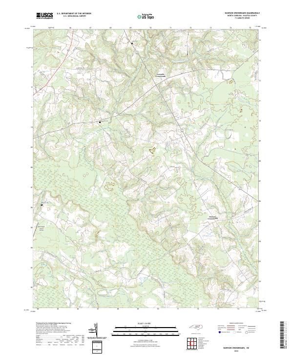
2022 Map of Dawson Crossroads
USGS Topo · Published 2022About this map
Crowells Crossroads and Dawson Crossroads anchor this rural landscape in Halifax County, where the topography is defined by the winding drainages of Conoconnara Swamp and Beech Swamp. The map reveals a deeply established agricultural network, marked by numerous family-named landmarks and infrastructure such as Douglas Hill Farm Rd and W W Cotton Farm Rd. For those tracing family histories in the region, the survey provides precise locations for Hales Cem, Westray Cem, and Pittman Cem. The local economy and transit patterns are further evidenced by the Dunroamin Farms Airport and a dense web of rural routes like Thirteen Bridges Rd and Old 125 Rd, which follow the higher ground between the many branches of Hales Millpond Br.
Find a feature on this map
40 named features on this map. Tap any name to fly to it.
Don’t see what you’re looking for? This feature index may not catch every label — zoom into the map to look around manually.
Map Details
Editions of this 2022 Dawson Crossroads Map
This is the sole edition of this map. No revisions or reprints were ever made.
Other maps of this area

1953 · Norfolk
USGS Topo · 1:250,000

1960 · Dawson Crossroads
USGS Topo · 1:24,000

1960 · Draughn
USGS Topo · 1:24,000

1961 · Whitakers
USGS Topo · 1:24,000

1961 · Enfield
USGS Topo · 1:24,000

1962 · Scotland Neck
USGS Topo · 1:24,000

1962 · Hobgood
USGS Topo · 1:24,000

1974 · Halifax
USGS Topo · 1:24,000

1974 · Boones Crossroads
USGS Topo · 1:24,000

1974 · Darlington
USGS Topo · 1:24,000