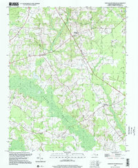
1997 Map of Dawson Crossroads
USGS Topo · Published 2000About this map
Beech Swamp and the dense network of Conoconnara Swamp define the hydrology of this Halifax County landscape, where small agricultural communities are linked by winding country roads. The settlement pattern is anchored by locations like Dawson Crossroads and Crowells Crossroads, which served as local focal points for rural life. For those tracing family histories in the area, the map preserves the location of several significant landmarks, including Whitakers Chapel, Mt Calvary Ch, and Dawson Sch.
Find a feature on this map
17 named features on this map. Tap any name to fly to it.
Don’t see what you’re looking for? This feature index may not catch every label — zoom into the map to look around manually.
Map Details
Editions of this 1997 Dawson Crossroads Map
This is the sole edition of this map. No revisions or reprints were ever made.
Other maps of this area

1953 · Norfolk
USGS Topo · 1:250,000

1960 · Dawson Crossroads
USGS Topo · 1:24,000

1960 · Draughn
USGS Topo · 1:24,000

1961 · Whitakers
USGS Topo · 1:24,000

1961 · Enfield
USGS Topo · 1:24,000

1962 · Scotland Neck
USGS Topo · 1:24,000

1962 · Hobgood
USGS Topo · 1:24,000

1974 · Halifax
USGS Topo · 1:24,000

1974 · Boones Crossroads
USGS Topo · 1:24,000

1974 · Darlington
USGS Topo · 1:24,000