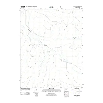
2011 Map of Dawson Draw
USGS Topo · Published 2011About this map
Disappointment Valley dominates this landscape, showing a complex network of canyons and draws characteristic of the high desert of southwest Colorado. The area's industrial history is well-documented through numerous mining claims concentrated in the north, including the Hornet Mine, Brown Mule Mine, and the Windy Day Mine. Further south, the Hidden Treasure Mine and North Continent Mine sit near the rugged drainage of Disappointment Creek.
Find a feature on this map
30 named features on this map. Tap any name to fly to it.
Don’t see what you’re looking for? This feature index may not catch every label — zoom into the map to look around manually.
Map Details
Editions of this 2011 Dawson Draw Map
This is the sole edition of this map. No revisions or reprints were ever made.
Other maps of this area

1916 · Paradox Valley
USGS Topo · 1:125,000

1922 · Paradox Valley
USGS Topo · 1:125,000

1948 · Hamm Canyon
USGS Topo · 1:24,000

1948 · Gypsum Gap
USGS Topo · 1:24,000

1949 · Gypsum Gap
USGS Topo · 1:24,000

1949 · Joe Davis Hill
USGS Topo · 1:24,000
1950 · Hamm Canyon
USGS Topo · 1:24,000

1950 · Joe Davis Hill
USGS Topo · 1:24,000

1956 · Cortez
USGS Topo · 1:250,000

1956 · Moab
USGS Topo · 1:250,000