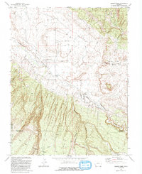
1993 Map of Dawson Draw
USGS Topo · Published 1993About this map
Uncompahgre National Forest and San Juan National Forest meet in this 1993 study of the high plateau and canyon country. The map centers on the drainage of Disappointment Creek, where the broad flat of the Valley is punctuated by irrigation and ranching infrastructure such as the Siphon, a Flowing Well, and the Daddy Williams Bridge. Evidence of human effort to extract value from this arid landscape is visible in the numerous Prospect markings and the more substantial Klondike site at the northern edge of Klondike Basin.
Find a feature on this map
28 named features on this map. Tap any name to fly to it.
Don’t see what you’re looking for? This feature index may not catch every label — zoom into the map to look around manually.
Map Details
Editions of this 1993 Dawson Draw Map
This is the sole edition of this map. No revisions or reprints were ever made.
Other maps of this area

1916 · Paradox Valley
USGS Topo · 1:125,000

1922 · Paradox Valley
USGS Topo · 1:125,000

1948 · Hamm Canyon
USGS Topo · 1:24,000

1948 · Gypsum Gap
USGS Topo · 1:24,000

1949 · Gypsum Gap
USGS Topo · 1:24,000

1949 · Joe Davis Hill
USGS Topo · 1:24,000
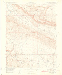
1950 · Hamm Canyon
USGS Topo · 1:24,000

1950 · Joe Davis Hill
USGS Topo · 1:24,000

1956 · Cortez
USGS Topo · 1:250,000

1956 · Moab
USGS Topo · 1:250,000