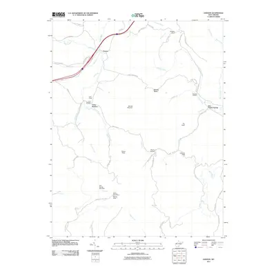
2011 Map of Dawson
USGS Topo · Published 2011About this map
Blue Sulphur Springs and the surrounding Greenbrier County highlands are captured here in a period of relative stillness, defined by small settlements and the winding course of the Meadow River. The landscape is a network of ridges and hollows, from the elevations of Bennett Mountain and Dougher Knob to the depths of Sawmill Hollow. This survey highlights the local infrastructure that supported these communities, such as the Grassy Meadows Post Office and the Keeney Mountain Lookout Tower, which served as a vital watchpoint on Keeney Knob. The arrangement of farm roads and river crossings like Lawn-Morris Brg illustrates how residents navigated the complex terrain between Dawson and the springs. Researchers will find numerous family-named landmarks including Tincher Ridge, Hamilton Ridge, and Leef Knob, alongside watercourses like Patterson Creek and Muddy Creek that shaped the rural economy.
Find a feature on this map
54 named features on this map. Tap any name to fly to it.
Don’t see what you’re looking for? This feature index may not catch every label — zoom into the map to look around manually.
Map Details
Editions of this 2011 Dawson Map
This is the sole edition of this map. No revisions or reprints were ever made.
Other maps of this area

1887 · Hinton
USGS Topo · 1:125,000

1892 · Hinton
USGS Topo · 1:125,000

1912 · Meadow Creek
USGS Topo · 1:48,000

1912 · Big Bend
USGS Topo · 1:62,500

1914 · Big Bend
USGS Topo · 1:62,500

1915 · Meadow Creek
USGS Topo · 1:62,500

1921 · Alderson
USGS Topo · 1:48,000

1921 · Clintonville
USGS Topo · 1:48,000

1923 · Clintonville
USGS Topo · 1:62,500
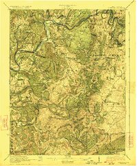
1923 · Alderson
USGS Topo · 1:62,500