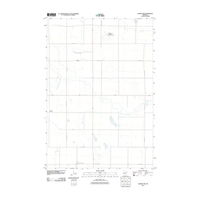
2010 Map of Dawson NW
USGS Topo · Published 2010About this map
The West Branch Lac qui Parle River meanders across this rural expanse of Lac qui Parle County, defining a landscape otherwise shaped by human geometry. Early 21st-century agriculture dominates the terrain, with the land meticulously organized into a grid by roads like County Hwy-14 and 170th St. This area reflects the deep-rooted agricultural heritage of western Minnesota, evidenced by the presence of the Hamlin Cemetery and Garfield Cemetery, which serve as quiet markers of the region's pioneering families and established rural communities. The modern utility of the land is balanced by the Madison-Lac Qui Parle County Airport in the north and a sophisticated water management system, including County Ditch Number Sixty-nine and County Ditch Number Eighty-five, which help regulate the fertile prairie soils.
Find a feature on this map
16 named features on this map. Tap any name to fly to it.
Don’t see what you’re looking for? This feature index may not catch every label — zoom into the map to look around manually.
Map Details
Editions of this 2010 Dawson NW Map
This is the sole edition of this map. No revisions or reprints were ever made.
Other maps of this area

1953 · Bellingham
USGS Topo · 1:62,500

1953 · Milbank
USGS Topo · 1:250,000

1953 · Watertown
USGS Topo · 1:250,000

1958 · Milbank
USGS Topo · 1:250,000

1958 · Watertown
USGS Topo · 1:250,000

1958 · Cerro Gordo
USGS Topo · 1:24,000

1958 · Madison
USGS Topo · 1:24,000

1967 · Dawson SW
USGS Topo · 1:24,000
1967 · Providence
USGS Topo · 1:24,000

1967 · Gary SE
USGS Topo · 1:24,000