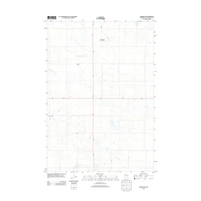
2013 Map of Dawson NW
USGS Topo · Published 2013About this map
Lac qui Parle County’s agricultural landscape is defined here by a network of drainage infrastructure, such as County Ditch Number Sixty-nine and County Ditch Number Seventeen. These engineered waterways crisscross the prairie, supporting the expansive farmsteads that characterize this portion of Western Minnesota. In the northern section of the sheet, the Lac Qui Parle County Airport sits adjacent to CO Road C, serving as a modern transportation hub for the rural community.
Find a feature on this map
9 named features on this map. Tap any name to fly to it.
Don’t see what you’re looking for? This feature index may not catch every label — zoom into the map to look around manually.
Map Details
Editions of this 2013 Dawson NW Map
This is the sole edition of this map. No revisions or reprints were ever made.
Other maps of this area

1953 · Bellingham
USGS Topo · 1:62,500

1953 · Milbank
USGS Topo · 1:250,000

1953 · Watertown
USGS Topo · 1:250,000

1958 · Milbank
USGS Topo · 1:250,000

1958 · Watertown
USGS Topo · 1:250,000

1958 · Cerro Gordo
USGS Topo · 1:24,000

1958 · Madison
USGS Topo · 1:24,000

1967 · Dawson SW
USGS Topo · 1:24,000
1967 · Providence
USGS Topo · 1:24,000

1967 · Gary SE
USGS Topo · 1:24,000