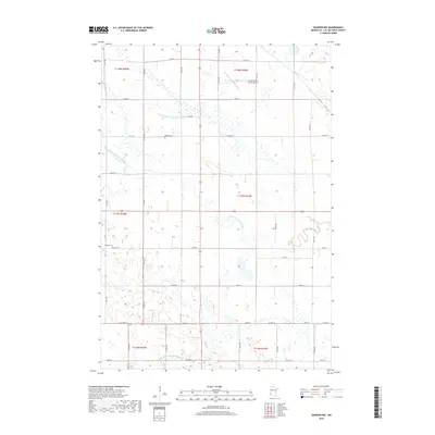
2019 Map of Dawson NW
USGS Topo · Published 2019About this map
The W Br Lac qui Parle River meanders through the heart of this agricultural landscape in Lac qui Parle County, revealing a highly managed hydrological system. The terrain is crisscrossed by an extensive network of drainage infrastructure, including County Ditch Number Sixty-nine, County Ditch Number Seventeen, and County Ditch Number Eighty-five, reflecting the region's long-standing focus on prairie reclamation for farming. Small local landmarks provide points of orientation for genealogists and local historians, most notably Hamlin Cem and Garfield Cem. The northern portion of the map is punctuated by the Lac Qui Parle County Airport, indicating modern connectivity for this rural area, while the rigid grid of section roads like 230th St and 150th St defines the human imprint on the land.
Find a feature on this map
28 named features on this map. Tap any name to fly to it.
Don’t see what you’re looking for? This feature index may not catch every label — zoom into the map to look around manually.
Map Details
Editions of this 2019 Dawson NW Map
This is the sole edition of this map. No revisions or reprints were ever made.
Other maps of this area

1953 · Bellingham
USGS Topo · 1:62,500

1953 · Milbank
USGS Topo · 1:250,000

1953 · Watertown
USGS Topo · 1:250,000

1958 · Milbank
USGS Topo · 1:250,000

1958 · Watertown
USGS Topo · 1:250,000

1958 · Cerro Gordo
USGS Topo · 1:24,000

1958 · Madison
USGS Topo · 1:24,000

1967 · Dawson SW
USGS Topo · 1:24,000
1967 · Providence
USGS Topo · 1:24,000

1967 · Gary SE
USGS Topo · 1:24,000