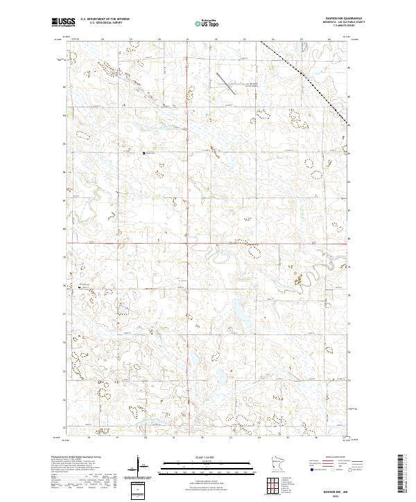
2022 Map of Dawson NW
USGS Topo · Published 2022About this map
Agricultural prairie and essential water management systems define this portion of Lac qui Parle County. The W Br Lac qui Parle River meanders across the landscape, supplemented by a network of engineered waterways including County Ditch Number Sixtynine and County Ditch Number Eightyfive. These features reflect the long-standing efforts to manage the region’s hydrology for farming. Genealogy researchers will find two distinct burial sites preserved within the section lines: Hamlin Cem and Garfield Cem. The northern portion of the map is punctuated by the Lac Qui Parle County Airport, indicating the area's modern infrastructure. The map is organized by a strictly rectilinear grid of local roads, such as Co Hwy 16 and Co Hwy 12, which follow the original township and range boundaries established during the initial settlement of the Minnesota frontier.
Find a feature on this map
26 named features on this map. Tap any name to fly to it.
Don’t see what you’re looking for? This feature index may not catch every label — zoom into the map to look around manually.
Map Details
Editions of this 2022 Dawson NW Map
This is the sole edition of this map. No revisions or reprints were ever made.
Other maps of this area

1953 · Bellingham
USGS Topo · 1:62,500

1953 · Milbank
USGS Topo · 1:250,000

1953 · Watertown
USGS Topo · 1:250,000

1958 · Milbank
USGS Topo · 1:250,000

1958 · Watertown
USGS Topo · 1:250,000

1958 · Cerro Gordo
USGS Topo · 1:24,000

1958 · Madison
USGS Topo · 1:24,000

1967 · Dawson SW
USGS Topo · 1:24,000
1967 · Providence
USGS Topo · 1:24,000

1967 · Gary SE
USGS Topo · 1:24,000