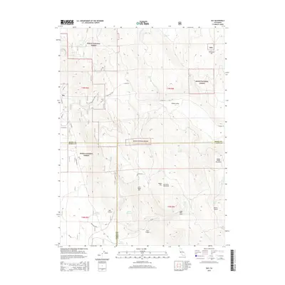
2015 Map of Day
USGS Topo · Published 2015About this map
Day marks the settlement center of this high-elevation landscape, situated at the jurisdictional meeting point of Modoc, Shasta, and Lassen counties. The 2015 survey reveals a complex network of forest roads and land management boundaries between the Modoc National Forest and Shasta National Forest. This interior region is defined by its water management and diverse terrain, with significant landmarks including Jimmerson Mtn and Little Baldy Mtn rising above the timbered basins. The presence of Indian Reservoir, Baldy Reservoir, and Clark Reservoir alongside named springs like Wendt Spring and Hamlin Springs highlights the critical role of water capture in this arid mountain environment. Local history and ranching roots are preserved through labels such as W Brown Ranch and the winding Widow Valley Road, which traces the contours of the Widow Valley Mountains.
Find a feature on this map
41 named features on this map. Tap any name to fly to it.
Don’t see what you’re looking for? This feature index may not catch every label — zoom into the map to look around manually.
Map Details
Editions of this 2015 Day Map
This is the sole edition of this map. No revisions or reprints were ever made.
Other maps of this area

1886 · Modoc Lava Bed
USGS Topo · 1:250,000

1892 · Modoc Lava-Bed
USGS Topo · 1:250,000

1954 · Alturas
USGS Topo · 1:250,000

1958 · Alturas
USGS Topo · 1:250,000

1961 · Bieber
USGS Topo · 1:62,500

1961 · Fall River Mills
USGS Topo · 1:62,500

1962 · Alturas
USGS Topo · 1:250,000

1962 · Crank Mountain
USGS Topo · 1:62,500

1962 · White Horse
USGS Topo · 1:62,500

1965 · Alturas
USGS Topo · 1:250,000