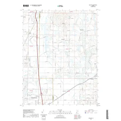
2019 Map of Daylight
USGS Topo · Published 2019About this map
Evansville occupies the southwestern corner of this survey, where urban development meets a complex network of agricultural drainage ditches along the Vanderburgh and Warrick county line. The landscape is defined by the winding course of Pigeon Creek and its many tributaries, such as Bluegrass Creek and Lick Creek. These watercourses are supplemented by a sophisticated system of man-made waterways including Stubbs Fruedenberg Ditch, Dennis Wagner Ditch, and Angel Ditch, illustrating the intensive land management required in this part of Indiana. Small settlements like Daylight, Chandler, and Fisherville dot the road network, which is anchored by historic routes like New Harmony Road and Petersburg Road. Local heritage is anchored by sites like the Blue Grass Church Cemetery and the Asbury Cemetery, while Little Ditney Hill provides a rare point of elevation in an otherwise low-lying, engineered terrain.
Find a feature on this map
111 named features on this map. Tap any name to fly to it.
Don’t see what you’re looking for? This feature index may not catch every label — zoom into the map to look around manually.
Map Details
Editions of this 2019 Daylight Map
This is the sole edition of this map. No revisions or reprints were ever made.
Other maps of this area

1901 · Haubstadt
USGS Topo · 1:62,500

1902 · Ditney
USGS Topo · 1:125,000

1902 · Boonville
USGS Topo · 1:62,500

1903 · Haubstadt
USGS Topo · 1:62,500

1903 · Patoka
USGS Topo · 1:125,000

1905 · Newburg
USGS Topo · 1:62,500

1914 · Henderson
USGS Topo · 1:48,000

1916 · Henderson
USGS Topo · 1:62,500

1951 · Yankeetown
USGS Topo · 1:24,000

1952 · Evansville
USGS Topo · 1:24,000