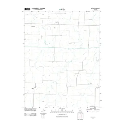
2011 Map of Dayton
USGS Topo · Published 2011About this map
The South Grand River meanders across this rural landscape, providing a primary drainage corridor for numerous tributaries that define the local geography. Small settlements including Dayton, Altona, and Aaron anchor the road network, which is predominantly comprised of section-line roads like S Wagoner Rd and E 355th St. The area's agricultural character is evidenced by the Leos Angus Ranch Airport, while a dense distribution of family and community burial grounds suggests a long-established residential history.
Find a feature on this map
37 named features on this map. Tap any name to fly to it.
Don’t see what you’re looking for? This feature index may not catch every label — zoom into the map to look around manually.
Map Details
Editions of this 2011 Dayton Map
This is the sole edition of this map. No revisions or reprints were ever made.
Other maps of this area

1887 · Harrisonville
USGS Topo · 1:125,000

1887 · Butler
USGS Topo · 1:125,000

1892 · Harrisonville
USGS Topo · 1:125,000

1894 · Harrisonville
USGS Topo · 1:125,000

1894 · Butler
USGS Topo · 1:125,000

1947 · Lawrence
USGS Topo · 1:250,000

1950 · Lawrence
USGS Topo · 1:250,000

1953 · Johnstown
USGS Topo · 1:24,000
1953 · Creighton
USGS Topo · 1:24,000
1954 · Quick City
USGS Topo · 1:24,000