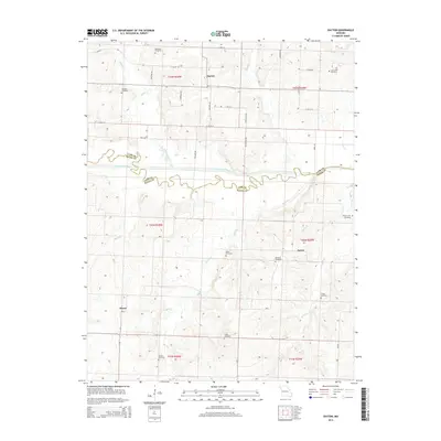
2014 Map of Dayton
USGS Topo · Published 2014About this map
The South Grand River meanders across this rural landscape where the border between Cass and Bates Counties is defined by the winding river channel. Small settlements and crossroads communities like Dayton, Aaron, and Altona anchor the region, which is primarily characterized by a dense network of country roads and agricultural parcels. The drainage patterns of the Elk Fork and Sugar Cr create a series of low ridges and valleys that dictate the placement of local homesteads and travel routes.
Find a feature on this map
47 named features on this map. Tap any name to fly to it.
Don’t see what you’re looking for? This feature index may not catch every label — zoom into the map to look around manually.
Map Details
Editions of this 2014 Dayton Map
This is the sole edition of this map. No revisions or reprints were ever made.
Other maps of this area

1887 · Harrisonville
USGS Topo · 1:125,000

1887 · Butler
USGS Topo · 1:125,000

1892 · Harrisonville
USGS Topo · 1:125,000

1894 · Harrisonville
USGS Topo · 1:125,000

1894 · Butler
USGS Topo · 1:125,000

1947 · Lawrence
USGS Topo · 1:250,000

1950 · Lawrence
USGS Topo · 1:250,000

1953 · Johnstown
USGS Topo · 1:24,000
1953 · Creighton
USGS Topo · 1:24,000
1954 · Quick City
USGS Topo · 1:24,000