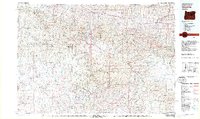
1981 Map of Dayville
USGS Topo · Published 1981About this map
The John Day River and its South Fork anchor this 1981 mapping of Central Oregon, where the high-desert plateaus meet the timbered slopes of the Ochoco Mountains and Aldrich Mountains. The settlement of Dayville sits at the confluence of these waters, serving as a hub for a landscape defined by expansive volcanic tables like Laughlin Table, Shaw Table, and Twelvemile Table. This edition, based on earlier surveys and mid-1970s aerial photography, documents the rural infrastructure of Grant and Wheeler counties, from the corridor of US Highway 26 to remote locations such as Negro Cabin and Delore Place. The map identifies localized industrial and resource sites, including the Waterman Mine and Roba Westfall Mine, alongside various forest service campgrounds and a small Landing Strip. Large portions of the terrain are managed as the Ochoco National Forest and Malheur National Forest, reflecting the region's long-standing reliance on public land for timber and grazing.
Find a feature on this map
53 named features on this map. Tap any name to fly to it.
Don’t see what you’re looking for? This feature index may not catch every label — zoom into the map to look around manually.
Map Details
Editions of this 1981 Dayville Map
2 editions found

Other maps of this area

1926 · Mitchell
USGS Topo · 1:125,000

1932 · Dayville
USGS Topo · 1:125,000

1936 · Dayville
USGS Topo · 1:125,000

1940 · Mount Vernon
USGS Topo · 1:62,500

1940 · Aldrich Mtn.
USGS Topo · 1:62,500

1940 · John Day
USGS Topo · 1:62,500

1943 · Aldrich Mtn.
USGS Topo · 1:62,500

1943 · John Day
USGS Topo · 1:62,500

1943 · Mount Vernon
USGS Topo · 1:62,500

1949 · Long Creek
USGS Topo · 1:62,500