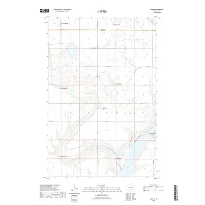
2020 Map of Dazey NE
USGS Topo · Published 2020About this map
Lake Ashtabula dominates the southeastern corner of this North Dakota landscape, where the waters are spanned by the Ashtabula Bridge. The surrounding terrain in Ashtabula Township is defined by the winding course of Baldhill Creek, which carves through the prairie as it drains toward the reservoir. For those tracing family histories in Barnes and Griggs counties, the map identifies two distinct burial sites: Sunnyside Cem / Ladbury Cem in the north and Saint Marys Cem further south. Modern recreation is represented by the N Country National Scenic Trail, which skirts the western shoreline of the lake and follows the contours of the creek valley. A grid of section roads, including 12th St SE and 18th St SE, provides a framework for the agricultural lands that characterize this part of the state.
Find a feature on this map
20 named features on this map. Tap any name to fly to it.
Don’t see what you’re looking for? This feature index may not catch every label — zoom into the map to look around manually.
Map Details
Editions of this 2020 Dazey NE Map
This is the sole edition of this map. No revisions or reprints were ever made.
Other maps of this area

1952 · Grand Forks
USGS Topo · 1:250,000

1952 · New Rockford
USGS Topo · 1:250,000

1956 · New Rockford
USGS Topo · 1:250,000

1956 · Grand Forks
USGS Topo · 1:250,000

1961 · Baldhill Dam
USGS Topo · 1:24,000

1961 · Hannaford
USGS Topo · 1:24,000

1961 · Rogers
USGS Topo · 1:24,000

1961 · Dazey NE
USGS Topo · 1:24,000

1961 · Dazey
USGS Topo · 1:24,000

1961 · Karnak
USGS Topo · 1:24,000
Featured Places
- Ashtabula Township, ND
- Rogers Township, ND
- Sibley Trail Township, ND
- Dazey Township, ND
- Barnes County, ND