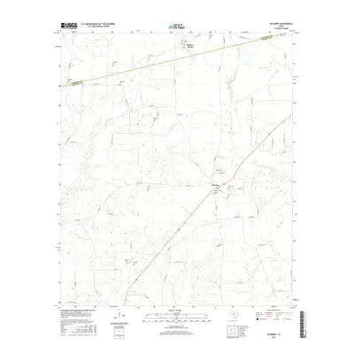
2016 Map of De Berry
USGS Topo · Published 2016About this map
Elysian Fields and De Berry anchor this rural landscape along the Harrison and Panola county line in East Texas. The map shows a region defined by its small family cemeteries and seasonal drainage creeks, including Tuttle Cr, Jackson Cr, and the W Fork Socagee Cr. These watercourses create a dissected terrain where local roads like FM 31 and FM 1794 weave through the timber and pastureland.
Find a feature on this map
66 named features on this map. Tap any name to fly to it.
Don’t see what you’re looking for? This feature index may not catch every label — zoom into the map to look around manually.
Map Details
Editions of this 2016 De Berry Map
This is the sole edition of this map. No revisions or reprints were ever made.
Other maps of this area

1943 · Waskom
USGS Topo · 1:62,500

1945 · Waskom
USGS Topo · 1:62,500

1945 · Socagee Bayou
USGS Topo · 1:62,500

1956 · Tyler
USGS Topo · 1:250,000

1956 · Deadwood
USGS Topo · 1:62,500

1958 · Darco
USGS Topo · 1:62,500

1958 · Carthage
USGS Topo · 1:62,500

1962 · Stricklin Springs
USGS Topo · 1:24,000

1962 · De Berry
USGS Topo · 1:24,000
1962 · Panola
USGS Topo · 1:24,000