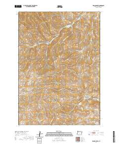
2020 Map of De Bord Peaks
USGS Topo · Published 2020About this map
De Bord Peaks rise above a deeply dissected landscape in Malheur County, where a network of seasonal watercourses and named canyons defines the terrain. The northern reaches of this territory are marked by Sheep Dip Canyon and Black Stump Canyon, suggesting a history of high-desert ranching and livestock management. The drainage pattern is complex, with Dutch John Cr and Little Cottonwood Cr feeding into larger systems that traverse the public land survey grid.
Find a feature on this map
24 named features on this map. Tap any name to fly to it.
Don’t see what you’re looking for? This feature index may not catch every label — zoom into the map to look around manually.
Map Details
Editions of this 2020 De Bord Peaks Map
This is the sole edition of this map. No revisions or reprints were ever made.
Other maps of this area

1908 · Ironside Mountain
USGS Topo · 1:125,000

1955 · Baker
USGS Topo · 1:250,000

1955 · Canyon City
USGS Topo · 1:250,000

1959 · Baker
USGS Topo · 1:250,000

1959 · Canyon City
USGS Topo · 1:250,000

1964 · Ironside
USGS Topo · 1:62,500

1966 · Clover Creek Ranch
USGS Topo · 1:62,500

1970 · Castle Rock
USGS Topo · 1:62,500
1972 · Rastus Mtn
USGS Topo · 1:24,000
1972 · Eldorado Pass
USGS Topo · 1:24,000