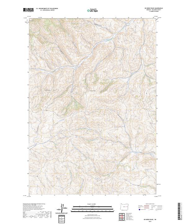
2024 Map of De Bord Peaks
USGS Topo · Published 2024About this map
De Bord Peaks rise as the central landmark of this high-desert landscape in Malheur County, where complex drainages like Rail Canyon and Cannon Gulch carve through the terrain. The map details a remote section of the Oregon interior, structured by a series of north-flowing water systems including Cottonwood Creek and South Willow Creek. The presence of Sheep Dip Canyon suggests the historic importance of sheep ranching in this high-altitude basin, a vital part of the regional agricultural economy during the twentieth century. Human access remains limited to rugged tracks such as Rose Creek Rd and Belknapp Rd, which navigate the steep rises near Ironside Mtn and Taxspa Butte. These corridors provide the primary connection between the varied creek systems, including Clover Creek and McArthur Creek, that define the local watershed.
Find a feature on this map
25 named features on this map. Tap any name to fly to it.
Don’t see what you’re looking for? This feature index may not catch every label — zoom into the map to look around manually.
Map Details
Editions of this 2024 De Bord Peaks Map
This is the sole edition of this map. No revisions or reprints were ever made.
Other maps of this area

1908 · Ironside Mountain
USGS Topo · 1:125,000

1955 · Baker
USGS Topo · 1:250,000

1955 · Canyon City
USGS Topo · 1:250,000

1959 · Baker
USGS Topo · 1:250,000

1959 · Canyon City
USGS Topo · 1:250,000

1964 · Ironside
USGS Topo · 1:62,500

1966 · Clover Creek Ranch
USGS Topo · 1:62,500

1970 · Castle Rock
USGS Topo · 1:62,500
1972 · Rastus Mtn
USGS Topo · 1:24,000
1972 · Eldorado Pass
USGS Topo · 1:24,000