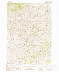
1990 Map of De Bord Peaks
USGS Topo · Published 1991About this map
De Bord Peaks and Squaw Butte anchor this high-elevation corner of Malheur County, Oregon, where a complex network of canyons and gulches defines the watershed patterns. The landscape is marked by numerous water sources, indicated by dozens of individually plotted Spring and Springs labels, which feed into larger drainages like South Willow Creek and Cottonwood Creek. The presence of Sheep Dip Canyon and a Water Tank points toward the area's utility for livestock ranging, a common practice in the high desert hinterlands. Transportation is limited to a network of unimproved tracks, labeled as 4wd, which navigate between prominent features such as Timber Gulch and Black Canyon. This provisional survey provides a snapshot of the remote backcountry as it was managed in the late 1980s, documenting the vital locations of water and the rugged access routes used by ranchers and outdoorsmen.
Find a feature on this map
27 named features on this map. Tap any name to fly to it.
Don’t see what you’re looking for? This feature index may not catch every label — zoom into the map to look around manually.
Map Details
Editions of this 1990 De Bord Peaks Map
This is the sole edition of this map. No revisions or reprints were ever made.
Other maps of this area

1908 · Ironside Mountain
USGS Topo · 1:125,000

1955 · Baker
USGS Topo · 1:250,000

1955 · Canyon City
USGS Topo · 1:250,000

1959 · Baker
USGS Topo · 1:250,000

1959 · Canyon City
USGS Topo · 1:250,000

1964 · Ironside
USGS Topo · 1:62,500

1966 · Clover Creek Ranch
USGS Topo · 1:62,500

1970 · Castle Rock
USGS Topo · 1:62,500
1972 · Rastus Mtn
USGS Topo · 1:24,000
1972 · Eldorado Pass
USGS Topo · 1:24,000