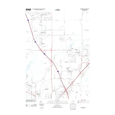
2013 Map of De Forest
USGS Topo · Published 2013About this map
De Forest and the neighboring community of Windsor anchor this landscape during a period of significant suburban expansion north of the state capital. The map illustrates a complex network of residential developments such as Raintree, Foxmoor Hills, and Sherwood Glen that have emerged alongside established agricultural landmarks like Barman Farms. These modern subdivisions are woven between natural features like the Yahara River and Token Creek, which feeds into the Token Creek Pond. The southern portion of the sheet is dominated by the northern reaches of the Dane County Regional Airport Truax Field and the Madison Prairie Landfill, reflecting the intersection of municipal infrastructure and growing residential life. Smaller clusters like Hoepkers Corners and Burke sit at key transportation nodes, including the junction of Us-51 and Wi-19.
Find a feature on this map
107 named features on this map. Tap any name to fly to it.
Don’t see what you’re looking for? This feature index may not catch every label — zoom into the map to look around manually.
Map Details
Editions of this 2013 De Forest Map
This is the sole edition of this map. No revisions or reprints were ever made.
Other maps of this area

1890 · Madison
USGS Topo · 1:62,500

1890 · Sun Prairie
USGS Topo · 1:62,500

1892 · Madison
USGS Topo · 1:62,500

1896 · Sun Prairie
USGS Topo · 1:62,500

1901 · Poynette
USGS Topo · 1:62,500

1904 · Madison
USGS Topo · 1:62,500

1905 · Sun Prairie
USGS Topo · 1:62,500

1906 · Madison
USGS Topo · 1:62,500

1907 · Sun Prairie
USGS Topo · 1:62,500

1955 · Columbus
USGS Topo · 1:62,500