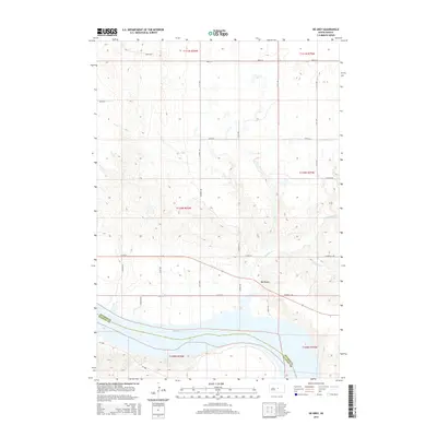
2015 Map of De Grey
USGS Topo · Published 2015About this map
De Grey sits on the northern banks of the Missouri River in this 2015 study, overlooking the expansive waters of Lake Sharpe. The landscape is defined by the sharp transition from the elevated plains of central South Dakota down to the river valley, where drainage patterns like Chapelle Cr and South Chapelle Creek carve through the terrain. This map shows the rural infrastructure north of the river, with a grid of section roads including Dunbar Road and Chapelle Road connecting the high country to the riverfront. The inclusion of the Hughes and Stanley county boundary line as it follows the river channel provides a clear look at the political geography of this reach of the Missouri. Further south, SD-1806 follows the shoreline, serving as the primary corridor through this sparsely populated riverine environment.
Find a feature on this map
28 named features on this map. Tap any name to fly to it.
Don’t see what you’re looking for? This feature index may not catch every label — zoom into the map to look around manually.
Map Details
Editions of this 2015 De Grey Map
This is the sole edition of this map. No revisions or reprints were ever made.
Other maps of this area

1934 · Canning
USGS Topo · 1:48,000

1937 · Canning
USGS Topo · 1:62,500

1953 · Huron
USGS Topo · 1:250,000

1954 · Pierre
USGS Topo · 1:250,000

1954 · Huron
USGS Topo · 1:250,000

1958 · Pierre
USGS Topo · 1:250,000

1966 · Joe Creek
USGS Topo · 1:24,000

1966 · Joe Creek NW
USGS Topo · 1:24,000

1967 · Canning
USGS Topo · 1:24,000

1967 · De Grey NE
USGS Topo · 1:24,000