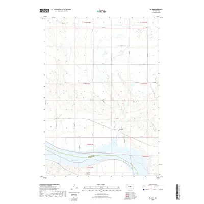
2017 Map of De Grey
USGS Topo · Published 2017About this map
De Grey sits near the northern banks of Lake Sharpe, an impoundment of the Missouri River that defines the southern boundary of this Hughes County landscape. The terrain is characterized by the winding path of Chapelle Cr and its tributary S Chapelle Cr, which cut through the high plains before meeting the river. Genealogists and local historians will find the Fort George Catholic Church Cem located just south of the river in Stanley County, providing a vital link to the area's early Catholic community. The map details a transition from the structured grid of rural roads like 309th Ave and 211th St to the more organic drainage patterns of the river breaks. Significant local transit routes, including SD 34 and Canning Rd, connect the small settlement of De Grey to the broader regional network during this period of the twenty-first century.
Find a feature on this map
32 named features on this map. Tap any name to fly to it.
Don’t see what you’re looking for? This feature index may not catch every label — zoom into the map to look around manually.
Map Details
Editions of this 2017 De Grey Map
This is the sole edition of this map. No revisions or reprints were ever made.
Other maps of this area

1934 · Canning
USGS Topo · 1:48,000

1937 · Canning
USGS Topo · 1:62,500

1953 · Huron
USGS Topo · 1:250,000

1954 · Pierre
USGS Topo · 1:250,000

1954 · Huron
USGS Topo · 1:250,000

1958 · Pierre
USGS Topo · 1:250,000

1966 · Joe Creek
USGS Topo · 1:24,000

1966 · Joe Creek NW
USGS Topo · 1:24,000

1967 · Canning
USGS Topo · 1:24,000

1967 · De Grey NE
USGS Topo · 1:24,000