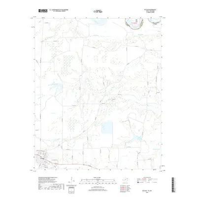
2019 Map of De Kalb
USGS Topo · Published 2019About this map
De Kalb serves as the primary hub in this corner of Northeast Texas, where the landscape transitions from established town streets to the marshy lowlands of the Red River basin. The northern boundary is defined by the winding river and the distinctive Billy Hall Bend, marking the border with Oklahoma. The terrain is defined by an intricate network of waterways, including Hooks Bayou and Mud Cr, which feed into various bodies of water such as Gunn Lake and Hatchel Lake. For those tracing local heritage, the map identifies several burial sites like Woodman Cem, Harrell Cem, and Harris Cem. The road network, featuring FM 992 and Farm Market 2735, illustrates the connection between the residential core of De Kalb and the surrounding agricultural and riparian lands that characterize Bowie County.
Find a feature on this map
58 named features on this map. Tap any name to fly to it.
Don’t see what you’re looking for? This feature index may not catch every label — zoom into the map to look around manually.
Map Details
Editions of this 2019 De Kalb Map
This is the sole edition of this map. No revisions or reprints were ever made.
Other maps of this area

1909 · New Boston
USGS Topo · 1:62,500

1930 · Bassett
USGS Topo · 1:62,500

1950 · De Kalb NW
USGS Topo · 1:24,000

1950 · Tom
USGS Topo · 1:24,000

1950 · De Kalb
USGS Topo · 1:24,000

1950 · Oak Grove
USGS Topo · 1:24,000

1951 · De Kalb
USGS Topo · 1:24,000

1951 · De Kalb NW
USGS Topo · 1:24,000

1951 · Tom
USGS Topo · 1:24,000

1951 · Oak Grove
USGS Topo · 1:24,000