
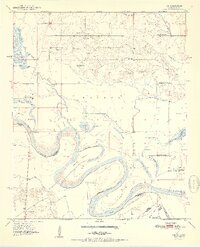
1951 Map of Tom
USGS Topo · Published 1951About this map
The Red River creates a meandering border between Oklahoma and Texas in this 1951 study of McCurtain County and Bowie County. The landscape is defined by the river's shifting path, evident in complex features like Severn Island and the Bailey Cut-off. This era reveals a rural community supported by local institutions, with the settlement of Tom serving as a central point for the surrounding area. Numerous small schoolhouses, such as Sand Hill Sch and Pleasant Grove Sch, are scattered across the terrain, indicating a decentralized educational system typical of the mid-century South.
Find a feature on this map
39 named features on this map. Tap any name to fly to it.
Don’t see what you’re looking for? This feature index may not catch every label — zoom into the map to look around manually.
Map Details
Editions of this 1951 Tom Map
2 editions found
Other maps of this area

1950 · De Kalb NW
USGS Topo · 1:24,000

1950 · Haworth
USGS Topo · 1:24,000

1950 · Tom
USGS Topo · 1:24,000

1950 · De Kalb
USGS Topo · 1:24,000

1950 · Oak Grove
USGS Topo · 1:24,000

1950 · Bokhoma
USGS Topo · 1:24,000

1951 · De Kalb
USGS Topo · 1:24,000

1951 · De Kalb NW
USGS Topo · 1:24,000

1951 · Haworth
USGS Topo · 1:24,000

1951 · Bokhoma
USGS Topo · 1:24,000