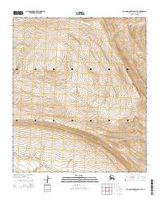
2015 Map of De Long Mountains D-1 NE
USGS Topo · Published 2015About this map
Tupikehak Cr winds through this expanse of the North Slope, serving as the primary drainage for the surrounding terrain. This 2015 survey, published by the U.S. Geological Survey in cooperation with the Alaska Dept. of Transportation, documents the intricate contour patterns of the De Long Mountains. The land is defined by Public Land Survey System divisions, including t5s r44w and t5s r43w, which help orient researchers within this expansive wilderness. The map provides precise topographic data for the Northwest Arctic region, illustrating the complex elevations that define the watershed of the Tupikehak Cr.
Find a feature on this map
5 named features on this map. Tap any name to fly to it.
Don’t see what you’re looking for? This feature index may not catch every label — zoom into the map to look around manually.
Map Details
Editions of this 2015 De Long Mountains D-1 NE Map
This is the sole edition of this map. No revisions or reprints were ever made.
Other maps of this area

1951 · De Long Mountains
USGS Topo · 1:250,000

1951 · Utukok River
USGS Topo · 1:250,000

1951 · Point Lay
USGS Topo · 1:250,000

1951 · Misheguk Mountain
USGS Topo · 1:250,000

1955 · De Long Mountains
USGS Topo · 1:250,000

1955 · Point Lay
USGS Topo · 1:250,000
1955 · Utukok River A-5
USGS Topo · 1:63,360

1955 · Point Lay A-1
USGS Topo · 1:63,360
1955 · De Long Mountains D-1
USGS Topo · 1:63,360

1956 · Misheguk Mountain
USGS Topo · 1:250,000