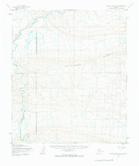
1955 Map of Utukok River A-5
USGS Topo · Published 1966About this map
The Kokolik River winds through this Arctic landscape, carving a deep valley through the northern Alaskan tundra. This 1955 survey highlights the prominent elevation of Archimedes Ridge, which stretches across the center of the sheet as a dominant geographical marker. The terrain reflects the remote character of the North Slope during the mid-20th century, a period defined by federal interest in resource management and exploration. The western portion of the map is significantly marked by the Naval Petroleum Reserve No 4 Boundary (Indefinite), indicating the vast tracts of land set aside for national energy interests. With no roads or trails recorded, the map captures a wilderness purely shaped by its hydrological networks and topographical contours before any significant infrastructure reached this part of the Brooks Range foothills.
Find a feature on this map
4 named features on this map. Tap any name to fly to it.
Don’t see what you’re looking for? This feature index may not catch every label — zoom into the map to look around manually.
Map Details
Editions of this 1955 Utukok River A-5 Map
2 editions found
Other maps of this area

1951 · De Long Mountains
USGS Topo · 1:250,000

1951 · Utukok River
USGS Topo · 1:250,000

1951 · Point Lay
USGS Topo · 1:250,000

1951 · Misheguk Mountain
USGS Topo · 1:250,000

1955 · De Long Mountains
USGS Topo · 1:250,000

1955 · Point Lay
USGS Topo · 1:250,000
1955 · Utukok River A-4
USGS Topo · 1:63,360

1955 · Point Lay B-1
USGS Topo · 1:63,360
1955 · Utukok River B-4
USGS Topo · 1:63,360

1955 · Point Lay A-1
USGS Topo · 1:63,360