
1955 Map of Point Lay B-1
USGS Topo · Published 1966About this map
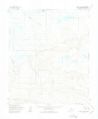
The Epizetka River and Kukpowruk River dominate this mid-century landscape in the remote North Slope. Photogrammetric methods from 1955 aerial photographs, later edited and published by the Geological Survey, capture a vast system of tundra wetlands and meandering waterways. The drainage patterns reflect the influence of the Kiklupiklak Hills and Amatusuk Hills to the south, which channel seasonal runoff toward the Arctic coast. The map also documents Kuvirok Lake, situated among countless unnamed thermokarst ponds typical of this permafrost region. Surveyed before modern infrastructure reached the area, the map shows land lines based on predetermined locations from the Bureau of Land Management rather than on-the-ground markers, reflecting the logistical challenges of Arctic mapping during the Cold War era.
Find a feature on this map
6 named features on this map. Tap any name to fly to it.
Don’t see what you’re looking for? This feature index may not catch every label — zoom into the map to look around manually.
Map Details
Editions of this 1955 Point Lay B-1 Map
2 editions found
Other maps of this area

1951 · Utukok River
USGS Topo · 1:250,000

1951 · Point Lay
USGS Topo · 1:250,000

1955 · Point Lay
USGS Topo · 1:250,000
1955 · Utukok River A-5
USGS Topo · 1:63,360
1955 · Utukok River C-5
USGS Topo · 1:63,360

1955 · Point Lay C-1
USGS Topo · 1:63,360

1955 · Point Lay A-1
USGS Topo · 1:63,360
1955 · Utukok River B-5
USGS Topo · 1:63,360
1955 · Point Lay B-2 & 3
USGS Topo · 1:63,360
1955 · Point Lay A-2
USGS Topo · 1:63,360