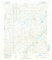
1955 Map of Utukok River B-5
USGS Topo · Published 1966About this map
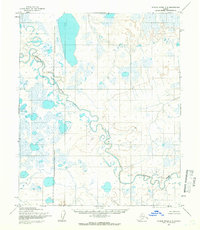
The Kokolik River winds through the North Slope of Alaska, providing a central drainage for this section of the Arctic tundra. The landscape is defined by the Kiklupiklak Hills, which rise in the southwestern quadrant, and a dense network of braided streams and small thermokarst lakes. A significant geopolitical marker on this sheet is the Naval Petroleum Reserve No 4 Boundary (Indefinite), which runs north-to-south across the western portion of the map. Surveyed by the Army Map Service in the mid-1950s using photogrammetric methods from aerial photographs, the map documents a largely unpeopled wilderness during a period of strategic military and resource exploration. The lack of roads or established trails highlights the isolation of this terrain, where movement was dictated by the river valleys and the seasonal conditions of the permafrost landscape.
Find a feature on this map
3 named features on this map. Tap any name to fly to it.
Don’t see what you’re looking for? This feature index may not catch every label — zoom into the map to look around manually.
Map Details
Editions of this 1955 Utukok River B-5 Map
2 editions found
Other maps of this area

1951 · Utukok River
USGS Topo · 1:250,000

1951 · Point Lay
USGS Topo · 1:250,000

1955 · Point Lay
USGS Topo · 1:250,000
1955 · Utukok River A-5
USGS Topo · 1:63,360
1955 · Utukok River A-4
USGS Topo · 1:63,360
1955 · Utukok River C-5
USGS Topo · 1:63,360

1955 · Point Lay B-1
USGS Topo · 1:63,360

1955 · Point Lay C-1
USGS Topo · 1:63,360
1955 · Utukok River B-4
USGS Topo · 1:63,360

1955 · Point Lay A-1
USGS Topo · 1:63,360