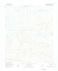
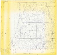
1955 Map of Point Lay B-1
USGS Topo · Published 1975About this map
Kukpowruk River and the Epizetka River meander through this remote portion of the North Slope, revealing a landscape defined by expansive drainage systems and high-latitude topography. This 1955 photogrammetric survey captures the area before modern infrastructure arrived, showing a network of unnamed tributaries and ponds that dominate the northern coastal plain. The terrain transitions from the low-lying basin surrounding Kuvirok Lake in the north to the more pronounced elevations of the Kiklupiklak Hills and Amatusuk Hills in the south. The absence of roads or established trails highlights the wilderness character of the region during the mid-twentieth century, while the inclusion of the Base Line provides a key surveying reference for these unsurveyed and unmarked land lines predetermined by the Bureau of Land Management.
Find a feature on this map
6 named features on this map. Tap any name to fly to it.
Don’t see what you’re looking for? This feature index may not catch every label — zoom into the map to look around manually.
Map Details
Editions of this 1955 Point Lay B-1 Map
2 editions found
Other maps of this area

1951 · Utukok River
USGS Topo · 1:250,000

1951 · Point Lay
USGS Topo · 1:250,000

1955 · Point Lay
USGS Topo · 1:250,000
1955 · Utukok River A-5
USGS Topo · 1:63,360
1955 · Utukok River C-5
USGS Topo · 1:63,360

1955 · Point Lay B-1
USGS Topo · 1:63,360

1955 · Point Lay C-1
USGS Topo · 1:63,360

1955 · Point Lay A-1
USGS Topo · 1:63,360
1955 · Utukok River B-5
USGS Topo · 1:63,360
1955 · Point Lay B-2 & 3
USGS Topo · 1:63,360