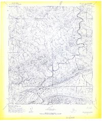
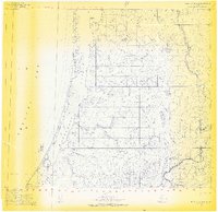
1955 Map of Point Lay A-2
USGS Topo · Published 1969About this map
The Kukpowruk River winds through this northern landscape, carving a deep path through the Amatusuk Hills as it flows toward the Arctic coast. This mid-century survey, based on aerial photography from 1955, reveals a remote wilderness defined by drainage patterns and geologic formations rather than human settlement. The Beaufort Basin occupies the southern portion of the map, where the terrain flattens significantly compared to the ridgelines of the hills. Tributaries such as Kuchiak Creek and Deadfall Creek illustrate the complex watershed of the North Slope, providing a detailed view of the natural topography before any modern infrastructure touched this region. This sheet represents an era of primary mapping by the Army Map Service, documenting the exact contours of unsurveyed and unmarked lands within the Umiat Meridian.
Find a feature on this map
5 named features on this map. Tap any name to fly to it.
Don’t see what you’re looking for? This feature index may not catch every label — zoom into the map to look around manually.
Map Details
Editions of this 1955 Point Lay A-2 Map
2 editions found
Other maps of this area

1951 · De Long Mountains
USGS Topo · 1:250,000

1951 · Point Lay
USGS Topo · 1:250,000

1955 · De Long Mountains
USGS Topo · 1:250,000

1955 · Point Lay
USGS Topo · 1:250,000

1955 · Point Lay B-1
USGS Topo · 1:63,360

1955 · Point Lay A-1
USGS Topo · 1:63,360

1955 · De Long Mountains D-2
USGS Topo · 1:63,360
1955 · De Long Mountains D-1
USGS Topo · 1:63,360
1955 · Point Lay A-3 & 4
USGS Topo · 1:63,360
1955 · Point Lay B-2 & 3
USGS Topo · 1:63,360