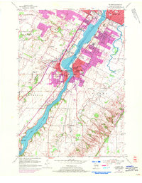
1954 Map of De Pere
USGS Topo · Published 1972About this map
The Fox River anchors this mid-century survey of Brown County, bisecting the twin communities of De Pere and West De Pere. The landscape reveals a transition from the dense urban corridor of Green Bay and Allouez in the north to the agricultural expanses of Lawrence and Rockland. Religious and educational institutions are prominent, notably the riverside campus of St Norbert College and several parochial schools like St Marys Sch.
Find a feature on this map
52 named features on this map. Tap any name to fly to it.
Don’t see what you’re looking for? This feature index may not catch every label — zoom into the map to look around manually.
Map Details
Editions of this 1954 De Pere Map
2 editions found
Other maps of this area

1954 · De Pere
USGS Topo · 1:62,500

1954 · Green Bay West
USGS Topo · 1:24,000

1954 · Denmark
USGS Topo · 1:62,500

1954 · De Pere
USGS Topo · 1:24,000

1954 · New Franken
USGS Topo · 1:62,500

1954 · Green Bay East
USGS Topo · 1:24,000

1954 · Manitowoc
USGS Topo · 1:250,000

1954 · Bellevue
USGS Topo · 1:24,000

1954 · Green Bay
USGS Topo · 1:62,500

1955 · Green Bay
USGS Topo · 1:250,000