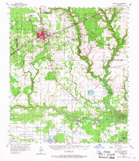
1956 Map of De Quincy
USGS Topo · Published 1968About this map
De Quincy stands as a rail-centered hub in the mid-1950s, defined by the junction of the Kansas City Southern Ry and the Missouri Pacific lines. This industrial landscape is deeply tied to energy extraction, with the Perkins Oil and Gas Field and De Quincy Field punctuating the piney terrain. To the south, the Houston River and the West Fork Calcasieu River dominate the lowlands, where transport was historically facilitated by the Anthony Ferry and Indian Bayou Ferry.
Find a feature on this map
55 named features on this map. Tap any name to fly to it.
Don’t see what you’re looking for? This feature index may not catch every label — zoom into the map to look around manually.
Map Details
Editions of this 1956 De Quincy Map
3 editions found
Other maps of this area

1932 · Lake Charles NW
USGS Topo · 1:31,680

1932 · Orange
USGS Topo · 1:62,500

1935 · Buhler
USGS Topo · 1:31,680

1935 · Moss Bluff
USGS Topo · 1:31,680

1935 · Gordon
USGS Topo · 1:31,680

1935 · Gaytine
USGS Topo · 1:31,680

1935 · Longville
USGS Topo · 1:31,680

1942 · Lake Charles
USGS Topo · 1:62,500

1947 · Sulphur
USGS Topo · 1:31,680

1947 · Gaytine
USGS Topo · 1:31,680